Friday, September 30, 2016

Hiking at Wallowa Lake Again

This morning we went back out to Wallowa Lake.  It's so beautiful out there.


We went out on trail number 1820, we think.  It's hard to tell, the kiosk uses four digit numbers to identify the trails.  Once on the trail, the signs use names.  Anyway, we think we were on 1820, than we headed up the trail marked the East Fork of the Wallowa River.  It's a nice trail.


The sun was out and the high winds had moved out the smoke that had been in the air.


We could hear, but not see the river on much of the trail.  This is where we stopped for lunch.  Notice all of the downed logs over the water.


This is why there's horse poop all over the trails.  Horses!


Thursday, September 29, 2016

A Drive on Oregon Highway 3

I walked out of the RV this morning and smelled smoke.  We drove up to the Enterprise airport, which is on top of a big hill, and this is what we saw down below.  There is a fire north of here.


We decided to drive north on Highway 3 to see what we would see.  First we saw buffalo.  There's a ranch just outside of Enterprise.  They're on the menu in Enterprise restaurants.


This is the Joseph Canyon Overlook.  The kiosk there talked about how the Nez Perce would travel with the seasons.  During the winter they would go to lower elevations.  They could not understand why the whites would stay at the higher elevations and endure the winters.  The Army wanted the Nez Perce out of the Wallowas.  One of the ways they forced them out was to set fire to their stored food for the winter.
Anyway, this was a very smoky part of the drive.


Up the road is a restaurant with attached tipi rentals and vintage RV rentals.  They have quite the view.


The road continued upward.  Look at the right side of the photo.  See the road tracing the side of the hills?


I got this off the web, this is Rattlesnake Grade.  That's a 20 mile per hour turn at the bottom.


This is the same curve, see the double log truck?  They tend to drive over the center line at a high rate of speed.


On the way back we went to see Flora.  Flora was platted on April 7, 1897. By 1910, it had a population of 200 residents and an eight-room school. It is considered "the most substantial town to fail" in the Northeast Oregon region.  Officially it's listed as a ghost town.


This is the old school, which has been turned into an arts center.


I'm too close to the church for you to see it, but this building is listing about 15 degrees.


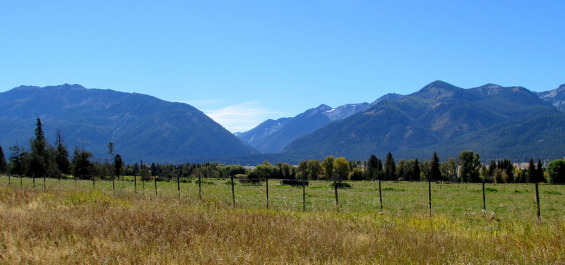
People still live up there, there are vast fields of growing things, as well as cattle.


We stopped at the Joseph Canyon over look again on the way back; still smokey.


Wednesday, September 28, 2016

Hell's Canyon Overlook and a Hike

We went back out to see the Hell's Canyon Overlook and the hike to the Blue Hole.  One accesses these sights via a forest service (paved!) road that is also open range.  We saw this big cow on the road.  Later, we saw a well camouflaged buff colored small cow.  He/she elected to leap into the road and run across in front of us.  Dumber than deer....


We went to the overlook first.  It is so spectacular, I wish I had a better camera.  Hell's Canyon is impressive.


Then it was off to the trail head to go see the salmon spawning.  When we were at the visitor's center, the guy at the desk told us that there would be a lot of fish.  Allegedly, they return from Ketchikan after a three year journey.  There were no fish.  I'm not sure if they're being held by the weir at the hatchery, or if it's too early/too late in the season, or if he was just jerking the tourists around.
It was not a great hike.  Much of it went through bushes on yet another trail full of loose dust that ruined yet another pair of socks.  It was surprisingly hot, as well.  Wah, call me a wahmbulance.


We reached the area known as the Blue Hole.  There was no light on it, so it was black.  Quel dommage. 


Here is Jim after climbing up on the giant rock outcropping.


Here we can see the rapids.


We tip toed out to the edge of a ledge so we could see the log jam.


Farther back down the creek.  This is where we would expect to see spawning.  The water is calm and there is gravel to hold the eggs.


The ranger said this was a beaver dam.  There was a downed log across the water and a bunch of other debris forming a pool in the trail.


We got about 4.5 miles on our feet so that was good. 
As beautiful as the woods are around here, I am more enchanted by the flat, agricultural areas of the valley.  The wheat fields go on forever.  It's like being on a different planet after spending time in cities.


Tuesday, September 27, 2016

Failure to Navigate in the Eagle Cap Wilderness

Today's plan was to drive out a trail head and then hike out to a pool where the salmon go to spawn.  Unfortunately our little xeroxed map was not totally clear on what road to take.  We headed out into the great wide open.  There are huge ranches out there. 
Isn't this a cool looking barn?


I love the main gate to the ranch.  See the bears?  There are cubs on the uprights.


We ended up on a gravel road, and kept driving.  Eventually the road got more narrow and we saw this sign.  Yep, at that point we were pretty sure we were not on the path to the spawning pool.


So, we went back to the main road and found the correct road.  We also discovered just how far it was to the trail head.  We have a goal to never be "those people" who make it on to the nightly news because they had to be rescued.  More fuel would be required for the truck.  We bailed on the plan and decided to drive out to Imnaha to see what we would see.
It's a beautiful drive.


This is Imnaha.  It's the end of the road.  There is a post office, bar/grocery store, and a bar/road house.  I think I saw about five homes.


On the way back we saw a cattle drive.  Unfortunately, I did not get the cowboy who was steering the cattle.


The day was still young so we drove over to Wallowa Lake.


We hiked up the Chief Joseph trail.  It was a lovely hike.


So, tomorrow we are going to try the hike to the salmon again.  This time we have a full tank of gas and a better understanding of the roads.

Monday, September 26, 2016

Riding the Joseph Branch Line

Today we rode the Joseph Branch rail line.  Work was begun on the line in 1907.  It starts in Elgin, and when completed made it to Joseph.  It was a working rail line until 1960.  The rail riders business was developed by the Metlins.  They used to own a bike store, which they sold, and then they developed this business using track that is not used by excursion trains.  It's only been going since 2014.  There is a good website describing them and the rail line which can be found here.
If you're in the area, you should do this.  It's just a hoot.  We signed up for the two hour tour, it's six miles from Joseph to Enterprise.  Going to Enterprise requires virtually no pedaling, coming back requires a little work.  It's so gorgeous.  We were very happy to be there.


The turn around is pretty cool.  The rail car is put on a "turn table" and reversed.


Here comes the "pusher" car.  If people get tired, he can fire up the engine and push them back up the hill.


He's taking the pusher off the rails so that the other cars can go by.


More beautiful scenery.


This is an osprey nest.  Apparently the builders spent time collecting colored materials for its construction.


Now we are back at the grain silo where the rail line ends.


This is a snip of a cell phone video of us.  Are we not adorable in our hats?