Wednesday, October 3, 2018

Issaquah to Pendleton, OR

Today’s route was all interstate; I90 to I82 to I84.  Under normal circumstances it would be an easy drive.

It was 42 degrees this morning with dense fog in Issaquah.  It rained a lot last night.  We know this because we tipped the nose of the RV down, and we got quite the run off of water from the slides.

IMG_4499

As we got 5 miles east of Issaquah, the fog lifted and the sun came out.

IMG_4514

Eastern Washington.  It’s a pretty place in its own way.

IMG_4543

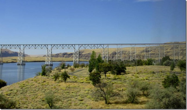
It was a speed limit drive until we almost reached the South Umtanum Summit.  Traffic came to a dead stop.  We inched along for awhile and then went over the other side, still doing about eight mph. That is the Fred Redmon bridge.  It’s hard to see, but no one is crossing that bridge.

P1370860

There are two Washington State Patrol cars creating a rolling slowdown.  We were paused for about 50 minutes.

IMG_4554

Finally, we reached the bridge. This guy (a WSP plain clothes detective) (notice the gun) and two other police were walking back to their cars.

P1370875

Washington State Patrol and Yakima Country Sheriffs were represented here.

P1370876

More Yakima police and some other departments were on the bridge as well.

P1370882

Members of many police organizations were standing on the bridge talking.  See what’s right down the hill?  It’s a rest stop.  I don’t know why they could not have cleared the bridge and taken the conversations down to the rest stop so that the multi mile backup could start clearing out.  They did a good thing, WSP, Yakima County and Yakima City police talked a 61 year old man off the bridge – he was threatening to jump.  I just question why they couldn’t clear the dang bridge once he had been taken away in an ambulance.

P1370886

That dark area far away is dark because of a huge grass fire.  We saw two fires today being put out along the side of the freeway.

P1370897

Eastbound traffic is being diverted onto the westbound bridge at the McNary Dam.  It looks like that project is going to take awhile.

P1370904

Tonight we’re once again at the Wild Horse Casino RV park, which I have previously reviewed.

Tuesday, October 2, 2018

Last Day in the GPNW

Aaarghhhhhhh!  We’re here two days too long.  It rained all day yesterday, varying between the annoying continuous mist and actual rain.  We accomplished much; did laundry, went to the grocery store, stuff like that.  Today we walked and did not get wet.  Tomorrow we’re leaving for the very last and very final time.

IMG_4495

The problem with my new crown was excess cement that was not removed from the back of the tooth.  It formed a shelf, and when I flossed the back of my tooth, it caught and went straight into my gums.  It was not a difficult fix, but one that really should not have been required.

I have more reason to hate Verizon, and you might, as well.  For the last three or so years, when we left Tucson or Seattle, I would cancel my DSL service.  Then I would call Verizon and ask them to put me back on the 30 gig plan for 30 days.  It was an old plan, not mentioned on their website, but available.  Well that’s no longer the case.  The old plans have been cancelled.  All they have now is small, medium and large, and their “unlimited” plans.  That would be the plan that starts throttling each device (including the jetpack) after 10 gig of use.  They do have a “super unlimited” that doesn’t throttle the jetpack, but you can only start that service at the start of a new billing cycle – by which time we’ll be back in Tucson.  So, if you have one of those old plans, think twice before letting go of it. 

Sunday, September 30, 2018

Walla Walla to Issaquah

It’s all a freeway drive.  There’s a fair amount of agriculture; wheat, hops, grapes, fruit trees.  Where there is irrigation, things grow.  It’s very productive land.  Eventually it becomes rolling hills, with less cultivation.

IMG_4435

Today’s key learning is don’t drive to Issaquah from the east on a Sunday.  There is a lot of traffic.  It would drop from a speed limit drive to a complete stop for no apparent reason.  There’s probably a corollary of don’t go east on Friday afternoons

IMG_4468

There are two truck plazas in Ellensburg.  Neither one of them are a good bet on a Sunday.  The Love’s channels everyone (cars, big trucks, RVs) in to the same entrance.  It was poorly marked and very chaotic.  The Flying J has very narrow spaces between the diesel pumps, and after pumping, there is nowhere to pull forward.  If you pull forward, no one can leave the car pumps.  I think I’d rather go to North Bend and pay too much in order to avoid Ellensburg.

The Indian John Hill rest stop has a dump station.  The way the rest stop is set up, the vehicles queuing to dump, back up into where the 18 wheelers need to park.  There were several big trucks caught in the line, unable to advance or depart.  So, approach this rest stop with the idea that you might want to keep going.

We’re back, and here for three nights.

Saturday, September 29, 2018

Blue Valley RV Park

While in Walla Walla we stayed at the Blue Valley RV Park.  It’s an ok park.  All sites are back ins, there are no pull throughs.

The park is in a light industrial part of town.  There is an annoying pulsing sound that goes for hours, day and night.  I think it might be a transformer but I could be wrong.  Down the street from the entrance is a homeless shelter.  They’re only allowed on premises at night, not during the day.  Some reviewers on rvparkreviews were upset about this, but we didn’t see any problems.

One of my biggest complaints about RV parks, is extraneous plantings.  See that green bush on the left?  It’s totally unnecessary.  It really complicated parking because we had to position the bus so the front edge of the slide didn’t hit the bush, and the back of it didn’t hit the power pedestal.

IMG_4385

The sites are kind of strange.  They’re not side by sides, they’re back to backs.  If two 5th wheels are back to back, they’re looking into each other’s big back windows.  It was ok for us since we have no windows in the back.

IMG_4380

Vehicle parking is to the side of the RV.

IMG_4383

Interior roads are paved, the side of the park we’re in has paved sites.  I think the other side is gravel, but I’m not positive about that.  Power is good, water pressure is really good.  Park wifi is good (that never happens!), I’ve done all of today’s posts on their wifi.  Each site has some grass and a picnic table.  It’s a nice looking RV park.

We would come back.  It would be nice not to hear the sound of alien space craft hovering overhead, but it’s not a deal breaker.  There are no trains and at night there’s no traffic noise.

Update June 30, 2019:  It appears that the aliens have departed.  We no longer hear their space craft hovering.

Tero Vineyards

We came to Walla Walla to see our friends Kim and Jim.  It’s been at least a year since we did. Yesterday we got to see their beautiful new house. Today Jim, Jim and I went out to Tero vineyards for a food and wine tasting event.  The people who catered it made really good food.  It was very pleasant sitting in the sun and chatting.  Kim was hard at work in another tasting room in downtown Walla Walla.  We feel bad that she was working and we weren’t.

Tero has not yet picked their grapes.  They’ve had to net the plants to keep the birds from eating the crop.  One hungry flock can lay waste to a season’s work.

IMG_4410

Kim was pouring in at the Tero tasting room at the Marcus Whitman Hotel.  It’s a gorgeous old building.  The ceilings are just magnificent.  I’m so happy that they have not remodeled it or updated it.

IMG_4411

It was good to see our friends.  It’s unfortunate that I took so few pictures.

Driving from Spokane to Walla Walla

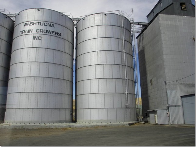
Yesterday we drove from Spokane to Walla Walla.  The route we chose was direct, but not necessarily efficient.  Spokane is up there in the top right hand corner of the map.  We took I90 to Ritzville and dropped south on WA-261.  The first section of WA-261 was fine.  It became much less fine after making the left just past Washtucna.

September 28 map

You see a lot of this on the first stretch of WA-261.  It’s fairly flat and you can see forever.

IMG_4203
.

IMG_4215

This is wheat country.  It stretches for miles.

IMG_4238

After making the left to stay on WA-261, it narrows and gets very noisy.  The surface is chip and seal and it’s really unpleasant.  The road also begins to undulate, sort of nap of the earth. It’s a very curvy little road. Eventually it reaches the Snake River, plunging down to the water.

IMG_4282

And here it is - The Bridge of Death.  It’s tall enough, but it’s not wide enough for two large vehicles to cross at the same time.  Worse, until you’re at the top of the bridge deck, you can’t see on coming traffic.  When we got to the top of the rise, we saw an 18 wheeler coming towards us.  Hyperventilating on my part ensued.  Fortunately, the truck driver stopped before getting on the bridge and let us drive off.  Even with that courtesy, Jim was really close to the guard rails on the passenger side, and our mirrors were very close to his side mirrors.  I can’t believe the DOT allows this situation to exist.  The could use lights and make it a one way bridge, but since the traffic volumes are so low, they probably have not yet had a spectacular accident.

IMG_4285

Once over the Snake, the terrain becomes more rolling, but it’s still covered in wheat.

IMG_4337
.

IMG_4364

It’s a beautiful drive.  However, next time we travel between Spokane and Walla Walla, we’re going the long way around.  We spent so much time going 40 mph that I think the longer route would be a push in terms of elapsed time.  We lucked out on the bridge over the Snake this time, but I would really prefer to not do that again.  If you’re in a Class C or B, you’ll be fine – enjoy the scenery!